Jim Donnelly
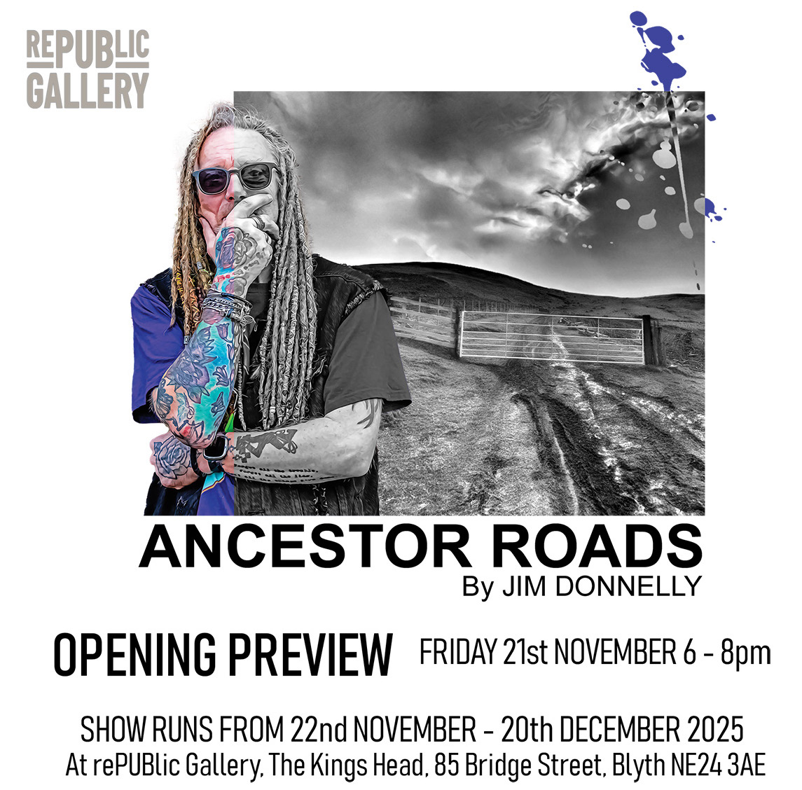
Ancestor Roads
In 325 BCE, the young Greek geographer Pytheas is recorded to have embarked on a voyage to explore the British Isles, a region referred to by the Greeks and Trojans as “the land of the people of forms.” As a diligent observer of geography and culture, Pytheas is believed to have made landfall at several locations around the British coastline to document the lives and customs of its inhabitants. One such location, according to some scholars, may correspond to the modern town of Amble on the Northumberland coast.
According to later accounts preserved by Hipparchus (writing approximately two centuries after Pytheas), the people of this northern region were described as living in thatched dwellings, storing their grain in subterranean pits, and baking bread from their harvests. Pytheas reportedly characterized them as “of simple manners,” content with modest fare, and governed by numerous kings and princes who largely coexisted in peace.
The inundation of the fabled Doggerland around 8,000 years ago permanently severed Britain from the European mainland, dramatically reshaping both its physical geography and the cultural trajectories of its Mesolithic populations. This cataclysmic event compelled rapid adaptation among Britain’s hunter-gatherer communities, who were forced to negotiate newly insular conditions and evolving ecosystems.
In the millennia between this inundation and the Roman occupation, the area now known as Northumbria—stretching approximately from the River Humber in the south to the Firth of Forth in the north—was inhabited by various tribal groups. Among these, the Votadini emerged as one of the most prominent in the northeastern region. Their territory encompassed parts of what are now southeastern Scotland and northeastern England, including modern Northumberland, Tyne and Wear, and the Scottish Borders.
The Votadini homeland comprised a strikingly varied landscape. To the north lay the rolling uplands and moorlands of the Cheviot Hills; to the east, an extensive North Sea coastline punctuated by cliffs, coves, and natural harbours; to the south, fertile river valleys such as those of the Tweed and Tyne, which supported both settlement and agriculture; and to the west, upland territories abutting the lands of neighbouring tribes. This geography positioned the region as a liminal borderland—far from isolated, it served as a connective zone for cultural and economic exchange through riverine corridors, valleys, and upland trackways.
Although formal roads were absent, the inhabitants of this landscape navigated an intricate network of well-worn footpaths and trackways. Routes traversing the Cheviot Hills afforded both visibility and relatively dry passage, while the Tweed and Coquet valleys functioned as vital communication and transport arteries. Coastal paths likewise facilitated fishing, trade, and movement between settlements and communal gathering places.
In modern-day Northumberland, these ancient pathways remain legible to the discerning eye. Many continue to serve as public rights of way or informal trails, their persistence a testament to the deep continuity of human movement across the landscape. For those who look closely, the presence of ancestral footsteps can still be traced along these enduring routes—echoes of the people who once walked them, and perhaps, in some real sense, still do.